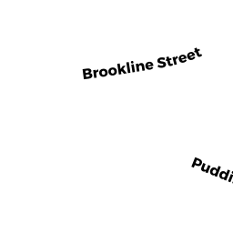
21 PUDDING STONE LA
Owner Information
WOLFF LISA K TR
21 PUDDING STONE LN
NEWTON, MA 02459


Property Details
21 PUDDING STONE LA is classified as a Single Family Residential (Modern/contemp).
The primary structure on this property was built in 1995. There are 11,255ft2 of built area within this property. There is 5,712ft2 of residential/living space within this property. This property is listed as having 10 rooms.
21 PUDDING STONE LA is valued at $2,761,500. The land is valued at $997,000 and the structures are valued at $1,764,500.
This property is in Zone SR1. Confirm with local Zoning Board authorities to ensure there are no overlays or other easements on this property.
The most recent deed for 21 PUDDING STONE LA is recorded at the local registrar in Book 69987, Page 409. 21 PUDDING STONE LA was last sold on Wednesday, September 27, 2017 for $262,453.
Assessment data from fiscal year 2022.
Flood Data
According to the FEMA National Flood Hazard Layer, this property does not appear to be in a flood zone. It may also be in an area not yet reviewed. Nonetheless, confirm this information prior to taking any action.
To view the flood hazards around this property, create a FEMA "Firmette" Map of the area around 21 PUDDING STONE LA.
Broadband Internet Providers
| Provider | Type | Bandwidth (mbps) | |
|---|---|---|---|
| Viasat Inc | Satellite | 100 | 3 |
| VSAT Systems, LLC. | Satellite | 2 | 1 |
| GCI Communication Corp. | Satellite | 0 | 0 |
| HughesNet | Satellite | 25 | 3 |
| RCN | Cable | 1000 | 20 |
| RCN | Cable | 500 | 20 |
| Comcast | Cable | 1000 | 35 |
| Verizon New England Inc. | Fiber | 940 | 880 |
| Verizon New England Inc. | DSL | 5 | 0 |
Broadband service provider data from December 2020.
Adjacent Properties
- 14 COLUMBINE RD
Single Family Residential owned by GOLD CANDY KOSOW - 22 COLUMBINE RD
Single Family Residential owned by YOO STEPHEN - 30 COLUMBINE RD
Single Family Residential owned by SHEN JINKUN - 35 PUDDING STONE LA
Single Family Residential owned by BROWNSTEIN RICHARD J & LAURIE S - 7 PUDDING STONE LA
Single Family Residential owned by BECKER LAURA B